
Subdivision & Area Maps
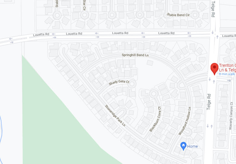
Google Map
Centered at The Reserve entrance. Drag it around to search nearby streets or use it as
a starting point for directions.
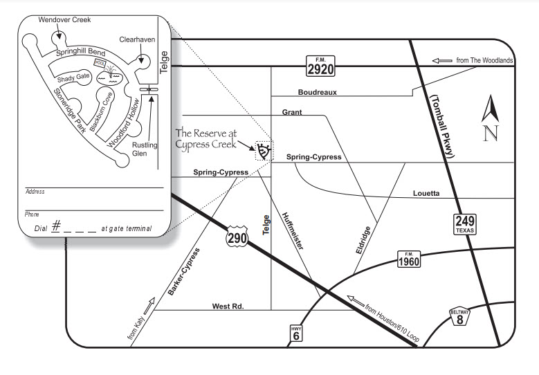
Directions Map
Printable custom map to give your guests directions to the Reserve. Just mark your location and make copies.
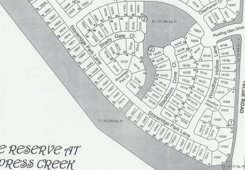
The Reserve Plat
Plat of subdivision showing streets and lot lines.
Transtar Traffic Map
Users can turn traveler information map features on and off, view detailed maps of the Houston region, zoom in and out of certain map locations, and click on hot links to various traveler information right from the maps with the Houston TranStar Traffic Mapping System.
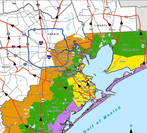
Hurricane Evacuation Planning
The Houston-Galveston area is particularly vulnerable to hurricanes. It may be required to evacuate parts of the Houston-Galveston region depending on the strength of the storm.
To ensure that you can evacuate quickly and safely, you must plan ahead of time.